Winter Weather
CONTENDING WITH JACK FROST: WHAT WE DON’T KNOW CAN HURT US
By Master Gardener Stephanie Wrightson

A number of articles on our UCCE Master Gardeners of Sonoma County website mention mid-November and mid-April as broad county averages for first and last frost dates, respectively. This seems to roughly work for Santa Rosa, but not necessarily for other parts of the county. Some Master Gardener authors mention different dates. For example, Master Gardener and food gardening author Steve Albert, who writes for a Kenwood newspaper, cites December as the month when frost typically appears in the Sonoma Valley. There is no one right prediction because of the county’s microclimates. A microclimate is, simply, a given climate and a given environment. And in light of the large geographic area covered by the county (north to south and coast to mountains), plus the wide variations in environment (elevation, direction of slope exposure, soil, density of vegetation, etc.), it is no wonder that the county has many, many microclimates.
While the past is not an absolute predictor of the future, past climate data is analyzed to determine the average first and last frost dates. The averages are derived from a 1971-2000 NOAA dataset that includes frost-freeze date probabilities for locations throughout the United States. In Sonoma County, climate data is reflected for six locations: Cloverdale, Graton, Healdsburg, Petaluma, Santa Rosa and Sonoma. Note that NOAA predicts 90-, 50- and 10-percent probabilities of frost occurring before or after a particular day for a particular location. The threshold temperatures in the dataset are significant: 36 degrees F suggests the potential for light frost; 32 F is the freezing point; 28 F is considered a hard freeze. Be aware that many seed company catalogs and online gardening sources only cite the 50-percent probability for 32 degrees F. It’s preferable to consider the full array of frost/freeze information in NOAA’s dataset. Remember that these are 30-year averages—apply the following information as a guideline, not gospel.
FALL—FIRST FROST DATE (probability of earlier date in fall than indicated):
| LOCATION | Thresholds (degrees F) |
10% Probability |
50% Probability |
90% Probability |
| Cloverdale | 36 32 28 |
Oct 15 Oct 16 Nov 12 |
Nov 12 Nov 23 Dec 26 |
Dec 10 Jan 1 -- |
| Graton | 36 32 28 |
Sep 25 Oct 20 Oct 31 |
Oct 18 Nov 6 Dec 2 |
Nov 9 Nov 23 Jan 4 |
| Healdsburg | 36 32 28 |
Nov 2 Nov 8 Dec 3 |
Nov 17 Dec 7 Jan 3 |
Dec 3 Jan 6 -- |
| Petaluma | 36 32 28 |
Oct 10 Oct 29 Nov 21 |
Nov 6 Nov 27 Dec 29 |
Dec 4 Dec 26 -- |
| Santa Rosa | 36 32 28 |
Oct 27 Nov 5 Nov 25 |
Nov 15 Dec 7 Dec 27 |
Dec 3 Jan 8 -- |
| Sonoma | 36 32 28 |
Oct 2 Oct 22 Nov 12 |
Oct 29 Nov 21 Dec 14 |
Nov 24 Dec 20 Jan 19 |
SPRING—LAST FROST DATE (probability of later date in spring than indicated):
| LOCATION | Thresholds (degrees F) |
90% Probability |
50% Probability |
10% Probability |
| Cloverdale | 36 32 28 |
Mar 4 Jan 7 -- |
Apr 4 Feb 21 Jan 10 |
May 6 Apr 7 Feb 10 |
| Graton | 36 32 28 |
Apr 17 Feb 27 Jan 2 |
May 12 Mar 30 Feb 5 |
Jun 6 Apr 29 Mar 11 |
| Healdsburg | 36 32 28 |
Feb 24 Jan 3 -- |
Mar 21 Feb 2 Jan 1 |
Apr 15 Mar 4 Jan 30 |
| Petaluma | 36 32 28 |
Feb 28 Jan 13 -- |
Apr 6 Feb 28 Jan 23 |
May 12 Apr 15 Mar 16 |
| Santa Rosa | 36 32 28 |
Feb 28 Jan 10 -- |
Mar 31 Feb 21 Jan 11 |
May 1 Apr 5 Feb 19 |
| Sonoma | 36 32 28 |
Mar 17 Jan 29 Dec 24 |
Apr 19 Mar 10 Jan 29 |
May 21 Apr 19 Mar 4 |
It is critical to know the difference between a frost advisory and a freeze warning, as well as terminology used in weather predictions. Case in point: covering plants before the sun sets can help retain heat near the plants when a frost advisory is issued. The same plant protection may have less impact following a freeze warning. NOAA’s definitions:
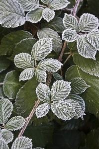
- Frost: The deposition of ice crystals directly on the surface of exposed objects. In the right conditions (clear skies, winds less than 6 mph) frost can occur when observed air temperatures are several degrees above freezing.
- Freeze: When observed air temperatures fall to 32 F or lower.
- Killing Freeze: When observed air temperatures fall to 30 F or lower for at least two consecutive hours.
- Frost Advisory: Issued when frost is forecast to occur at 3 or more weather observation sites.
- Freeze Warning: Issued when a freeze is expected to occur at 3 or more observation sites.
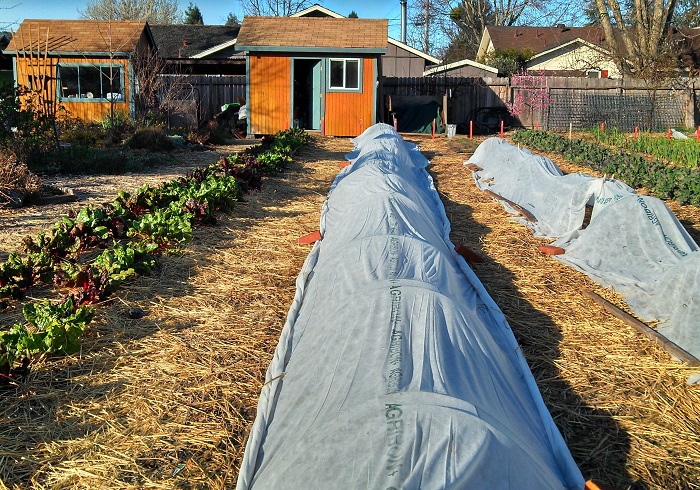
As evident by the definitions above (involving three or more observation sites), a single site may be subject to severe climate conditions despite there being no advisory or warning. Therefore, we must be aware of our gardens’ unique cold threat indicators. Depending on the size and characteristics of our property, we may find a multitude of variations in climate and other conditions affecting our crops’ ability to withstand cold weather. These include topographical dips and elevation, canopy cover, wind and wind breaks, heat-absorbing/reflecting structures, water-holding capacity of and moisture in the soil, ground cover, etc. All must be analyzed in order to make an informed decision as cold weather approaches. These factors can be complicated. Consider, for example, how cold air flows: it is denser than warm air, flows downhill and accumulates in low spots. However, if there is a structure (building, fence, berm, etc.) or heavy vegetation on a hill, the flow can be redirected toward or away from a crop. A prevailing wind also can affect the flow of cold air, and the orientation of a hill (south- vs. north-facing) can impact soil and plant storage of energy from the sun. Humidity and dew point have an impact on air temperature and frost. On a clear night, we may experience temperature inversions (when air temperatures near the ground are at or below freezing allowing ice crystals to form despite the possibility that the air temperature higher up is above freezing). Moist soil can hold up to four times more heat than dry soil. Vegetative mulches and grass or weed covers reduce the transfer of heat from the sun’s energy to the soil. The protection chosen (cold-frame, frost blanket, cloche, heat lamps, insulating walls of water, etc.) also affords extra degrees of protection to crops (up to 8 degrees depending on the material and thickness of the row cover).

We can’t address all of the factors in detail because there are too many environmental variables that exist and climate is a complex subject. But, using the basic information above, we can skew the odds in our favor by understanding our location in the county as well as our personal garden terrain, modifying our environment to increase heat retention when possible, avoiding the high-risk percentage frost dates, matching the cold-hardiness of fruits and vegetables to our winter gardening conditions, setting optimal indoor seed-starting and transplant dates, being prepared to apply timely and adequate protection to frost-tender crops and diligently following daily weather predictions. Good luck this winter and may the force (solar energy of the sun) be with you.
REFERENCES:
- 7-Day Forecast for Santa Rosa, National Weather Service of National Oceanic and Atmospheric Administration (NOAA) (enter zip code in search field for other locations)
- Frost Protection for Citrus and other Subtropicals, University of California, Division of Agriculture and Natural Resources
- Cold Frame Lettuce, UCCE Master Gardeners of Sonoma County
- Frost Protection for Sensitive Plants, UCCE Master Gardeners of Sacramento County
- Frost tip: Don't touch your plants, UCCE Master Gardeners of Marin County
- Keeping plants safe in winter freezes, UCCE Master Gardeners of Santa Clara
- Vineyard Frost Protection, UC Cooperative Extension, Mendocino County
- Sonoma County Climate Zones (description and map)
- Frost Protection Page (resources for commercial viticulture), UC Cooperative Extension, Sonoma County
- Frost or Freeze (impact on olives), UC Cooperative Extension, Sonoma County


